Aerial Intelligence
Beyond Photography: The Power of Intelligence
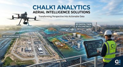
Traditional aerial photos tell you what is there; our intelligence tells you what to do next. By leveraging advanced sensors and photogrammetry, we deliver comprehensive aerial data analysis, creating a detailed digital record of your site.
Precision Mapping: Our high-resolution 2D ortho-mosaics provide a survey-grade, "current-state" view of your operations, offering accuracy and relevance that far surpass satellite imagery.
3D Digital Twins: We create immersive, measurable models of structures and terrain, enabling you to perform volumetric calculations, elevation analysis, and vertical inspections safely from your desk.
Rapid Deployment & Safety: Capture critical data in hours rather than days, significantly reducing project downtime while keeping your personnel out of hazardous environments.